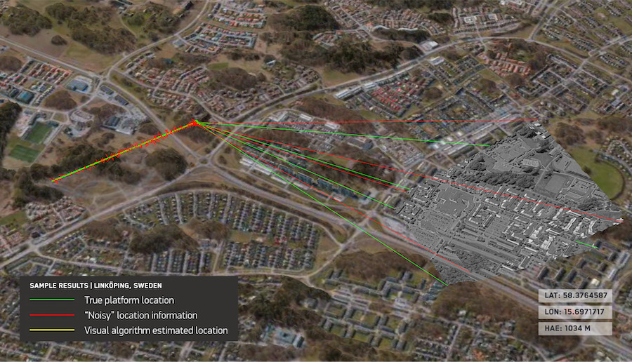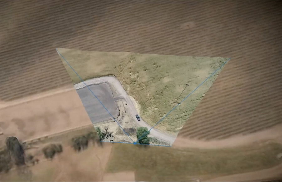

Maxar Intelligence has launched a vision-based software suite that enables autonomous drones to navigate and locate precisely without GPS signals.
The GPS, or Global Positioning System, is the US government-owned satellite-based navigation system with worldwide usage.
However, it can be disrupted and denied due to topography, such as in remote terrain and dense cities, and through deliberate intervention, such as signal jamming and spoofing.
Without GPS, aerial platforms can lose track and miss their targets.
Read the full story on our new publication, NextGen Defense: Maxar Unveils Software That Lets Drones Navigate Without GPS