
The US Naval Research Laboratory (NRL) has tested a computer-enabled mobile targeting system for the littoral battlespace at a military convention in Washington, DC.
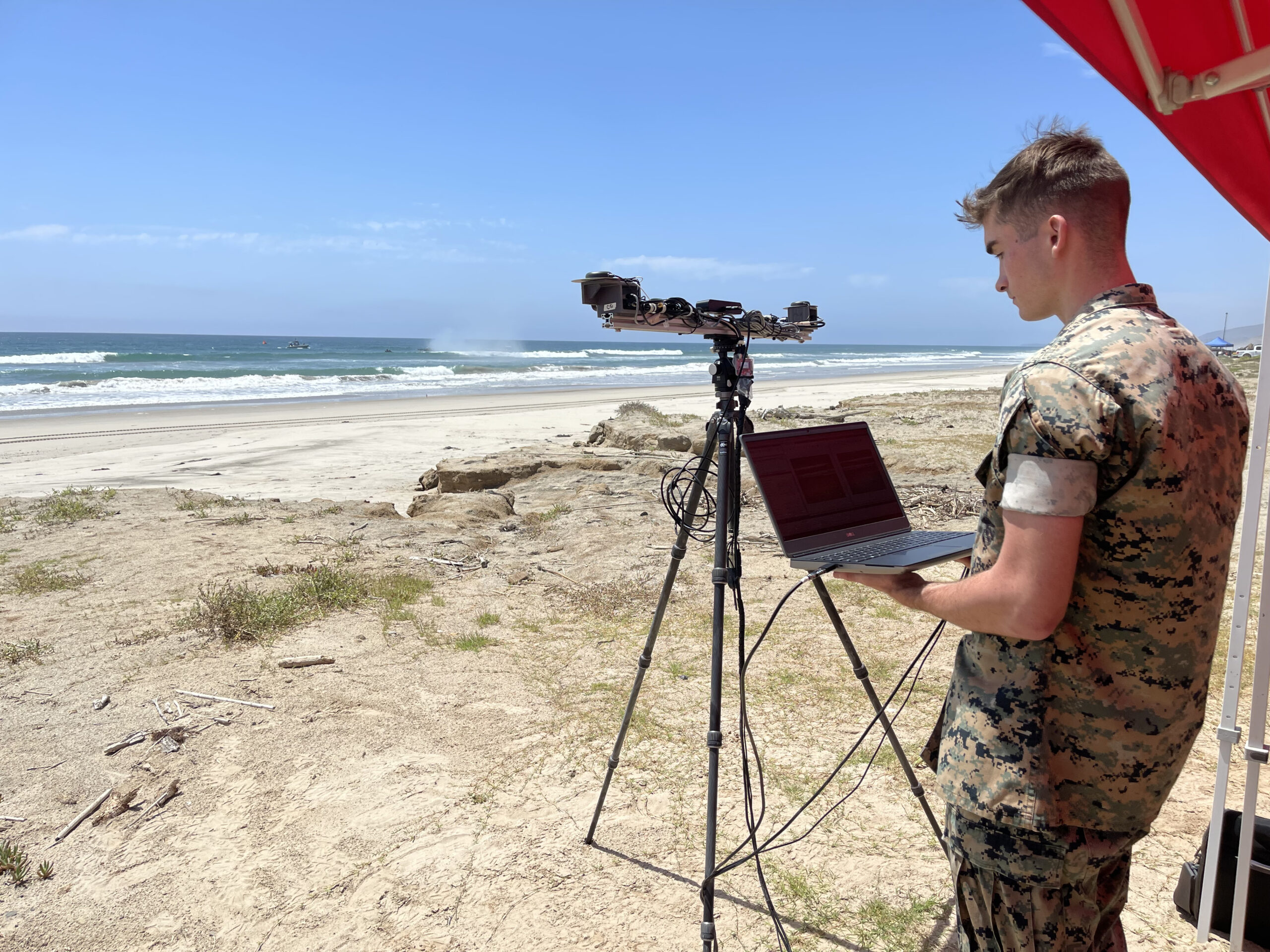
The “single-person-portable” LittoralLens capability runs automated measurements of littoral surface water velocities and wave data to calculate movements in real time.
It was designed to support tactical decisions for operational maneuvers from the sea (OMFTS), which combines naval and marine operability between sea and land.
LittoralLens can assist manned and unmanned assets, including amphibious combat vehicles, across shore-to-sea and vice versa.
“The system’s small-form-factor enables onboard analysis on mobile platforms, such as a lightweight tactical vehicle like the Polaris MRZR,” NRL Ocean Sciences Principal Investigator and LittoralLens Co-Inventor Blake Landry explained.
“LittoralLens estimates Surf Observations parameters to provide Modified Surf Index values, a mission-critical parameter that characterizes the surf zone and serves as a go/no threshold for US Marine Corps OMFTS.”
Computer-Based Technology
NRL highlighted that the LittoralLens’ point-and-shoot functionality is powered by a patented tracking velocimetry algorithm that is integrated with specialized hardware to sustain image processing in austere coastal environments.
Information gathered is then consolidated with other measurements collected by multiple sensors and unmanned aerial systems on the user’s Android Tactical Assault Kit handheld display and observation dashboard for on-site readings, future techniques, and training purposes.

“The LittoralLens system automatically estimates surf zone statistics via custom developed stereo reconstruction and geo-registration algorithms integrated with feature tracking routines,” LittoralLens Co-Inventor and Lead Algorithm Developer Carlo Zuniga-Zamalloa stated.
Development Under TechSolutions Program
NRL wrote that the LittoralLens effort is part of the broader TechSolutions program, which seeks innovative prototypes to address modern problems for sailors and marines.
TechSolutions is led by the agency in partnership with the Office of Naval Research-Global (ONR-Global) and is funded by the Marine Corps Surf Observation Tool for Littoral Expeditionary Operations project.
Related technologies are being assembled with the help of the US Army Engineering Research and Development Center (ERDC) Field Research Facility.
“TechSolutions links warfighters to the government science and technology community to help develop needed technologies as quickly as possible,” ONR-Global TechSolutions Program Director Jason Payne remarked.
“Our goal is to have a solution prototype in the hands of the requesting Sailor or Marine within 12 months.”
“This August, NRL, ONR-Global TechSolutions, and US Army ERDC are scheduled to conduct a final concept demonstration at Marine Corps Base Camp Pendleton, in Oceanside, California, at the Technical Concept Experiment and to put the technology in the hands of Marines that originated the request for a solution of ONR-Global TechSolutions Program in the first place.”